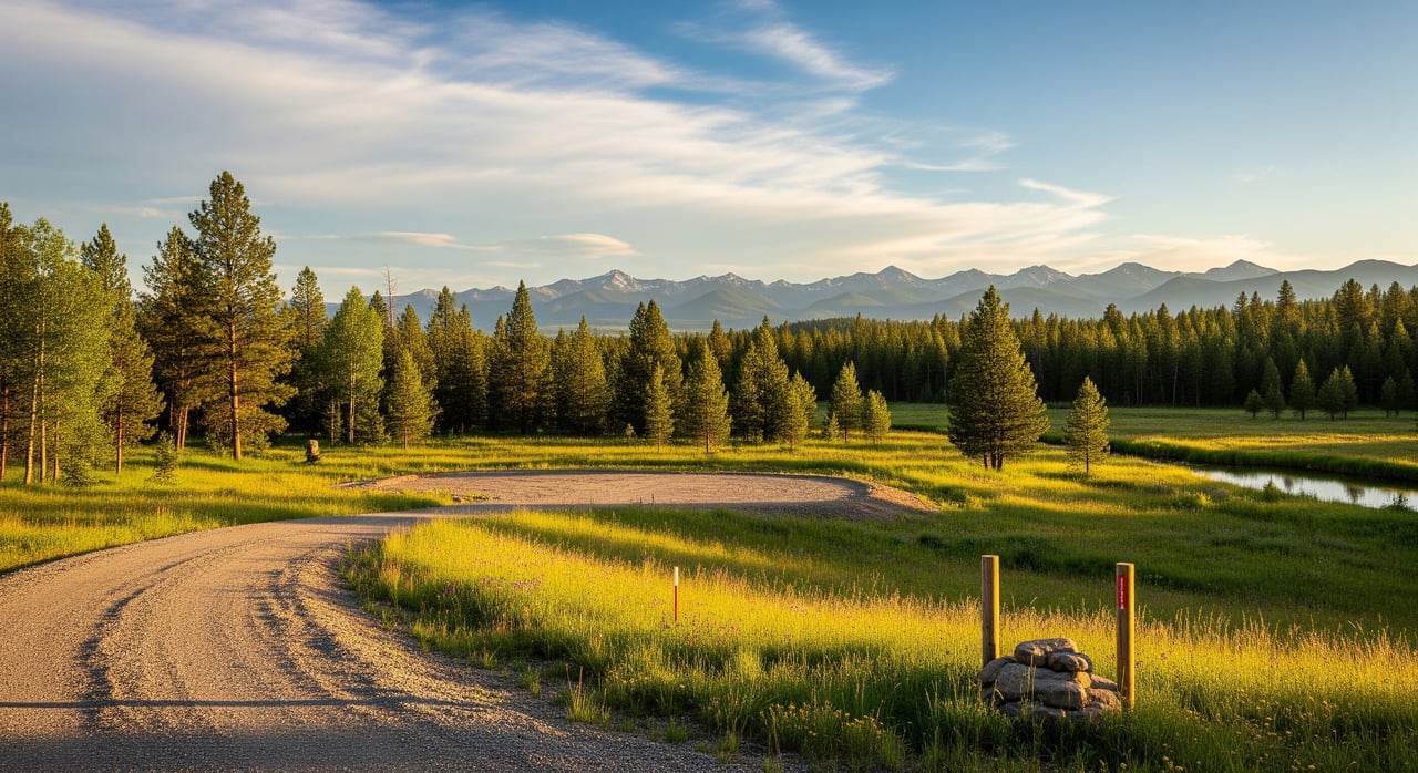
You have a lot of choices when it comes to land around Trego. The photos can look beautiful, but the real value comes down to access, utilities, soils, timber, and the fine print in the records. If you want confidence before you write an offer, you need a clear, step‑by‑step way to vet each parcel. This guide gives you exactly that, with practical checks tailored to Lincoln County so you can move forward with clarity. Let’s dive in.
Know your primary use
Before you pull maps, get clear on how you plan to use the property. Recreational buyers often prioritize seclusion, nearby public lands, and views. Investors tend to focus on legal access, timber marketability, buildability, and resale potential. Your priorities will shape which tradeoffs are acceptable and which are deal breakers.
Verify access first
Legal access and physical access are not the same. Legal access is a recorded easement or deeded right‑of‑way. Physical access is the actual road, its condition, and whether it is open in winter. Confirm access in the deed, recorded easements, county records, and a title commitment.
- Look for deeded access from a public road. Avoid parcels that rely on unrecorded permission.
- Ask who maintains the road, how often it is plowed, and how costs are shared. Seasonal gates and private bridges can affect year‑round use.
- Check for utility easements if you plan to build or harvest timber in the future.
Red flags: a vague “access by easement” with no recorded document, access across third‑party parcels without rights, or no deeded access at all.
Read the survey and plat
A current, certified boundary survey reduces risk. If the parcel is part of a subdivision, review the recorded plat and any accompanying maps or declarations. Compare assessor parcel data to the deed for acreage consistency.
- Walk the corners and look for monuments. If you cannot find them, plan for a new survey.
- Watch for fences or driveways that do not match the legal lines.
- If you plan to build or subdivide, a new boundary survey is often worth the cost.
Red flags: no recorded survey, unclear corners, or major differences between deeded acreage and assessor records.
Check covenants and zoning
Covenants, conditions, and restrictions can limit what you build and how you use the land. Zoning sets permitted uses, setbacks, and minimum lot sizes. Lincoln County also administers septic, well, and building permitting.
- Ask for recorded CC&Rs and any HOA rules. Look for limits on building type, seasonal use, timber harvest, or short‑term leasing.
- Confirm zoning and any overlay rules that may apply to shorelines, riparian areas, or wetlands.
- Ask about special districts for road maintenance, fire protection, water, or sewer.
Red flags: rules that prohibit your intended use or require costly improvements and fees.
Evaluate timber like an asset
Around Trego, forests can add recreational appeal and potential timber value. To understand that value, look at species, age, volume, and access for equipment. Market conditions and haul distances matter.
- Hire a consulting forester for a timber cruise if timber income is important. They estimate merchantable volume and likely stumpage rates.
- Confirm there are no recorded timber reservations or liens in title.
- Know that steep terrain or poor roads can erase potential profit.
For forestry guidance at the state level, review programs and resources through the Montana Department of Natural Resources and Conservation.
Map topography, soils, and water
Steep slopes, challenging soils, and water features drive cost and feasibility. Slopes over roughly 25 percent often require engineered roads and foundations, and can complicate septic approval.
- Use USGS topographic maps and county GIS to understand slope and terrain.
- Review soils on the USDA NRCS Web Soil Survey for septic suitability, depth to bedrock, and drainage.
- For septic permitting and wastewater standards, consult the Montana Department of Environmental Quality.
- Check flood risk on the FEMA Flood Map Service Center. Riparian areas carry setbacks and protections.
- For water supply, look up typical well depths and yields through the Montana DNRC. Some areas have limited groundwater.
Red flags: inability to pass a perc test, high groundwater or shallow bedrock, lots within a mapped floodplain, or unstable slopes.
Confirm utilities and services
Power, communications, and emergency response all affect daily use and cost. If grid power is far away, plan for trenching costs or an off‑grid solution.
- Identify the nearest power lines and confirm extension costs with the utility.
- Check cell coverage and internet options, including satellite or fixed wireless.
- Ask which fire district serves the parcel and plan for defensible space on forested sites. Northwest Montana’s wildfire season makes this important.
Red flags: long, expensive power runs, no realistic year‑round road access for utility crews, or no service providers for internet.
Clear title and mineral rights
Order a preliminary title report early. It should identify easements, liens, covenants, and any reserved rights. In Montana, mineral rights are often severed from the surface estate.
- Confirm who owns the minerals and whether the mineral owner has access rights.
- Look for timber reservations, recorded hunting or leasing agreements, and special assessments.
- Ask the title company if they can insure your intended use, including construction or subdivision.
Red flags: severed minerals with broad surface access rights, unreleased timber sales or liens, or title exceptions the title company will not insure.
Trego‑area context to keep in mind
Parcels near Trego sit within a patchwork of private lands, ranches, and large blocks of federal forest. Boundaries with public land add recreational value but also require careful access checks. For boundary and map context, use Kootenai National Forest resources and USFS map tools.
Northwest Montana winters bring heavy snow and seasonal closures. If you need year‑round access, verify plowing, gates, and any bridge limits before you fall in love with a view. Utility access and emergency response can also be seasonal on private roads.
Quick checklists you can use
Pre‑visit checklist
- Get the legal description and recorded deed.
- Pull the plat map and assessor parcel map.
- Order or review a preliminary title report.
- Check county GIS for parcel lines, slope, streams, and roads.
- Run a floodplain check on the FEMA Flood Map Service Center.
- Review soils on the NRCS Web Soil Survey and well data on the Montana DNRC.
- Call the listing agent to confirm access, utilities, surveys, and any CC&Rs.
On‑site checklist
- Locate posted corners and note visible monuments.
- Drive and walk the access route, including gates, creek crossings, and grades.
- Photograph access points, steep slopes, water features, and improvements.
- Note proximity of power lines, cell signal, and neighboring land uses.
- Identify potential septic and well locations on suitable terrain.
- Observe timber health, species mix, and any beetle kill or fire damage.
Questions to ask the listing agent
- Is access deeded, and where is the recorded easement?
- Any disputes related to boundaries, access, or HOA?
- Are there recorded CC&Rs or rules that limit use? Can you send copies?
- Has the parcel been surveyed or corner‑staked recently?
- What utilities are at the road, and are utility easements recorded?
- Any perc test, well log, active permits, or expired approvals?
- Any recorded timber sales, leases, or mineral reservations?
Questions for your title company or attorney
- What easements affect access or development?
- Are mineral rights severed, and who owns them?
- Any liens, judgments, or unrecorded claims?
- Can title be insured for construction or subdivision?
- Any outstanding assessments or special district fees?
Questions for a forester, surveyor, or soils pro
- Forester: What merchantable volume and species mix are on site, and what access is needed to log?
- Surveyor: Are corners monumented, and do boundaries match the deed? What is the cost for a certified survey?
- Soils: Is a conventional septic feasible at likely building sites, and what constraints exist?
Valuation and deal structure tips
- Buildability drives value. Budget for survey, perc test, well drilling, septic, driveway, power extension, and any culverts or small bridges.
- If timber is part of your plan, get a professional cruise and weigh harvest costs against stumpage. Steep slopes and limited access reduce value.
- Expect tighter lending. Rural land loans often require higher down payments, plus insurable title and verified access.
- Protect yourself with contingencies. Make the offer contingent on survey, title approval, septic and well feasibility, verified access, and a timber appraisal if relevant.
Your next step
If you want a clear read on a Trego parcel, bring in a local guide who knows the maps, the seasons, and the paperwork. I can help you line up the right checks and negotiate with confidence. Reach out to Charity Waldo to talk through a specific listing or to start a tailored land search.
FAQs
What should I check first when evaluating Trego land?
- Start with legal access in the deed and recorded easements, then confirm physical access conditions and winter maintenance before anything else.
How do I know if a parcel is landlocked in Lincoln County?
- Review the recorded deed, plat, and a title report for access easements; if there is no public road frontage and no recorded easement, the parcel may be landlocked.
Can I rely on county GIS lines for boundaries?
- Treat GIS as approximate; verify with a recorded survey and on‑the‑ground monuments, and commission a new survey if corners are unclear.
What makes or breaks septic approval on rural lots?
- Soil type, depth to bedrock, drainage, slope, and groundwater level; a soils evaluation or perc test is often required for permitting.
How do I check flood risk near creeks or the Kootenai River?
- Use the FEMA Flood Map Service Center to see if any part of the parcel lies within a mapped floodplain, then verify on site.
Where can I research typical well depths in the Trego area?
- Review well logs and water information through the Montana DNRC to understand depths, yields, and general water quality trends.
Who can estimate timber value on a forested parcel?
- Hire a consulting forester for a timber cruise that estimates species mix and merchantable volume, and ask them about local stumpage and access costs.